
This buoy was first deployed in May 2025. It is located just upstream of the location of the former Key Bridge, which collapsed on March 26, 2024, after a container ship struck one of the Bridge’s support piers. The collapse killed six construction workers.
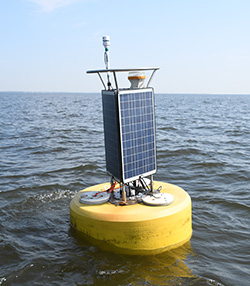
The Port of Baltimore is a major shipping center for the United States. It’s the largest U.S. port for roll-on/roll-off cargo; this includes cars and light trucks. It is among the top 20 ports by tonnage and the number of containers handled. The Baltimore buoy location gives shipping interests important information on weather conditions as they arrive at Baltimore Harbor.
Baltimore holds a lot of history, too. The valiant defense of Fort McHenry, located upstream from the Baltimore CBIBS buoy, during the Battle of Baltimore on September 13–14, 1814, inspired Francis Scott Key to write the words that became the U.S. national anthem.
Be sure to check the weather forecast before you head out.
For more information on the history of the area surrounding the Baltimore buoy, please visit:
Data from the buoy is available via data tools.