
A buoy was first deployed at Stingray Point on July 19, 2008. While this buoy is located far enough south that it has remained in the water over winters, intermittent data gaps do exist due to equipment failures.
On July 17, 1608, Captain John Smith and his group of explorers ran aground at the mouth of the Rappahannock River. While they waited for the tide to come up, Smith speared a ray while fishing. The ray stung Smith in the wrist, and Smith's arm, shoulder, and chest swelled from the ray's toxin. Fearing death, Smith discussed funeral plans with his group. A doctor with the group assisted, and by evening, Smith was well enough to eat the ray for dinner. The location has been called Stingray Point ever since.
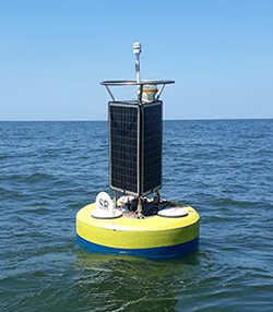
Today, Deltaville, a small community whose population swells each year during the summer vacation season, is located near Stingray Point. Many residents and visitors enjoy boating on the Rappahannock River and Bay. The Stingray Point CBIBS buoy is roughly a mile off shore.
Be sure to check the weather forecast before you head out.
For more information on the history of the area surrounding the Stingray Point Buoy, please visit:
Data from the buoy is available via data tools.