
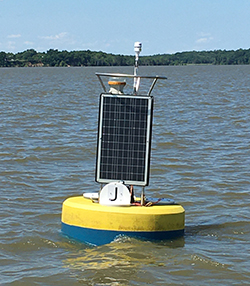
A buoy was first deployed at Jamestown on April 25, 2007. It was the first buoy to be deployed as part of the NOAA Chesapeake Bay Interpretive Buoy System. The buoy has often been pulled over the winter to keep it safe from potential ice damage (it is in fairly fresh water with a higher freezing point than more-saline locations in Virginia waters), so overwinter data gaps exist. There are also other intermittent data gaps, including significant outages in 2018 and 2020-2021. While the buoy was redeployed in July 2021, equipment failed in late August 2021. Due to difficulties in getting the needed parts to fix the buoy, it is not feasible for the CBIBS team to repair the buoy before the team would need to pull it for the winter, so it will not be redeployed again in 2021.
On May 14, 1607, the Virginia Company explorers landed on Jamestown Island, to establish the Virginia English colony on the banks of the James River 60 miles from the mouth of the Chesapeake Bay. By one account, they landed there because the deep-water channel let their ships ride so close to shore that they were able to secure the ships by tying them to trees. A team of archaeologists are currently revealing the mysteries of the Historic Jamestown settlement. Excavation since 1994 has uncovered hundreds of thousands of artifacts dating to the first half of the 17th century.
Be sure to check the weather forecast before you head out.
For more information on the history of Jamestown and areas surrounding the James River buoy, please visit:
For more in depth analysis please visit data tools.