
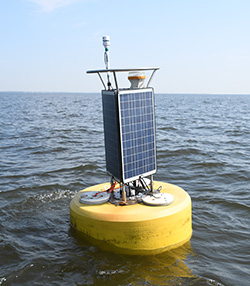
A CBIBS buoy was deployed at the mouth of the Patapsco River on July 12, 2023. Previously, a buoy was stationed at this location from July 21, 2007, to December 4, 2017. This buoy is pulled most winters to keep it safe from potential ice damage, so there are data gaps many years from December/January through March/April. Other intermittent data gaps exist at this location. Data from when the buoy was deployed are available via data tools.
"We passed many shallow creekes, but the first we found Navigable for a ship, we called Bolus (Patapsco), for that the clay in many places under the clifts by the high water marke, did grow up in red and white knots as gum out of trees." - Captain John Smith, 1608
Today ships are a common sight on the Patapsco River, which is home to one of the top ports in the world, the Baltimore Harbor. The shipping channels for this busy port are clearly visible on NOAA charts for the area.
Be sure to check the weather forecast before you head out.
For more information on the history of the area, please visit: