
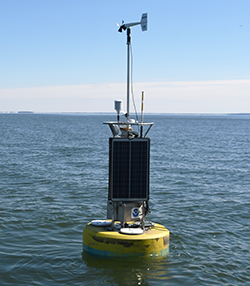
A buoy was first deployed at Gooses Reef on July 27, 2010. This buoy has occasionally been pulled over the winter to keep it safe from potential ice damage, so overwinter data gaps exist. There are also other intermittent data gaps. The buoy is in the middle of the Bay in a fairly wide part of the estuary, west of the mouth of the Eastern Shore's Little Choptank River and east of Dares Beach, Maryland.
Captain John Smith and his crew passed by Gooses Reef several times on their two exploratory voyages in the Chesapeake Bay. At that time—400 years ago—the area likely featured a large oyster reef reaching nearly to the surface. Today, the buoy location is the site of an innovative restoration project, marked on NOAA charts as a fish haven. Rubble from what was the Woodrow Wilson Bridge was placed on the bottom here to create habitat, thanks to support from the Dominion Foundation and the Maryland Artificial Reef Initiative.
Be sure to check the weather forecast before you head out.
For more information on the history of Gooses Reef and areas surrounding the buoy, please visit:
For more in depth analysis please visit data tools.