
John Jacobs is a Research Fishery Biologist with NOAA’s National Ocean Service at the Cooperative Oxford Lab on Maryland’s Eastern Shore. John works with a NOAA team that develops predictive models for vibrio bacteria in the Chesapeake Bay water and oysters.
Vibrio naturally live in certain coastal waters and are present in higher concentrations between May and October when water temperatures are warmer. Vibrio can cause illness or skin infections. While in most cases, people recover after just few days, in rare cases, infections caused by some types of vibrio can be quite serious—even deadly. The predictive models that John and his team develop are clearly important for public health, and help people who ensure food safety.
What role do John and his team play? They develop and fine-tune computer models that predict the likely occurrence of vibrio in locations around the country (including the Chesapeake Bay).
“We do this by determining the relationship between vibrio abundance and distribution and water quality variables, and then developing spatial models using this information to display our predictions. Models by nature are not perfect, so to keep them as accurate as possible, we check the model daily against the CBIBS data throughout the Bay and correct it if needed. Without this real-time system in place, we would not be able to offer accurate predictions, or know daily if the models are working correctly,” John explained.
Because the team uses a large amount of data every day, they have set up an automated process to access CBIBS data through NOAA’s National Data Buoy Center. Because they work on models for the entire Chesapeake, they use data on parameters including temperature and salinity from all buoys that are on line.
John also uses the CBIBS website to check on conditions, graph a few months of data, and plan upcoming research projects.
In addition to the work on vibrio, the National Ocean Service also does ecological forecasting on harmful algal blooms and hypoxia.
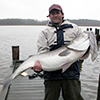
As you may have guessed from the photo, John also uses data from CBIBS buoys in his life outside work, too—he uses “mostly the Gooses Reef buoy to check on conditions outside the Choptank for fishing. Wind speed, direction, and wave height are the variables I use the most.”
Using CBIBS data for both work and outside of work, John knows well that CBIBS observations can be used by a wide range of interests.
“There are a variety of different reasons people use water-quality data for recreational, commercial, and scientific endeavors. In addition, they are extremely helpful for the education of our next generation of Bay users. Having the data easily accessible to the public allows for users to explore the data however they like and whenever convenient. This removes the traditional barriers of the data all being housed with the agencies, and delays in access to current data.”
We couldn’t agree more—having data at your fingertips, for however you’d like to use it—is a major goal for CBIBS.