
Gregg Stickler is the lead science teacher at Rising Sun High School in Maryland’s Cecil County. He uses CBIBS data with students—in a unique way!
Gregg’s advanced placement environmental science students use data from CBIBS and other sources when they study Chesapeake Bay and pollution issues related to sediments, nitrates and phosphates. To do this, Gregg uses NOAA’s Chesapeake Exploration educational, interactive website to develop investigations that guide his students through these topics. He first learned about CBIBS during a professional development session at Rising Sun HS.
“We look at turbidity, dissolved oxygen, chlorophyll, nitrates, and temperature,” Stickler explained. “Fertilizer pollution, potential algal blooms, and impacts on dissolved oxygen a topic studied.”
Because the Susquehanna CBIBS buoy is closest to Rising Sun HS, that’s the buoy at which they track observations most frequently.
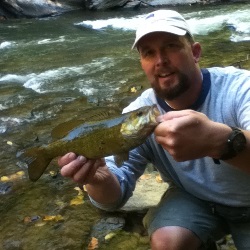
As evident in the photo—taken while Gregg was fishing in Octoraro, Creek, which flows past his home, through Cecil County, and on into the Susquehanna River below the Conowingo Dan—Gregg enjoys spending time in and around the Bay and its tributaries. He notes that the Octoraro “is my connection to the Bay and makes for a nice float trip.”
“I enjoy fishing and kayaking. The buoys provide information that can be used as an indicator of probable fish activity,” he described.
“CBIBS data for the Chesapeake Bay is a great resource for the public. Many of my students and their families here in Cecil County recreate on the Bay, boating, fishing, and crabbing,” he said. “The buoys are an excellent source of information that we can use for guidance and increased safety.”