
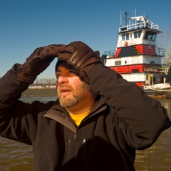
Greg Garman, Ph.D., is the director of the Center for Environmental Studies and research director at Virginia Commonwealth University’s Rice Rivers Center, located on the James River near Charles City, Virginia.
The Chesapeake Bay Interpretive Buoy System provides critical infrastructure for Dr. Garman’s work: Not only do they track real-time information on river conditions to let him and his team know what to expect when they conduct research work out in the field, the James River CBIBS buoy also includes a receiver that tracks tagged fish.
Dr. Garman’s work includes research to support restoration of endangered Atlantic sturgeon. A special fish tag receiver on the James River CBIBS buoy notifies him every time one of the tagged Atlantic sturgeon swims near the buoy, giving researchers a look at sturgeon movement in the area.
“In 2013, Virginia Commonwealth University and NOAA will deploy additional real-time acoustic receivers on CBIBS buoys and other structures, providing a more comprehensive and timely picture of sturgeon movements into the James River and near likely spawning habitat upstream,” Dr. Garman describes. “Such information on sturgeon coastal and riverine migration patterns is a critical element of ongoing recovery efforts for this federally endangered and iconic species in Chesapeake Bay and elsewhere.”
“This is especially true for the James, which still supports a relatively small but viable population of Atlantic sturgeon. Real-time access to sturgeon locations and movements could also help to reduce the incidence of sturgeon ship-strike mortalities in the James.”
Richmond, Virginia, is an active shipping port on the James River; sturgeon are large fish that often travel in deeper water, like the shipping channel in the river. Understanding more about where and when sturgeon swim could help inform shipping interests.
Currently, the data—which describe when a tagged fish (indicated by a numerical “name”) swims near the buoy—is not available on the live CBIBS website. NOAA and researchers are exploring ways to share more data in the future.
Dr. Garman, who was introduced to CBIBS in a meeting hosted by NOAA for fisheries biologists involved in fish telemetry research, generally accesses data about tagged fish via website, but notes that the smartphone apps work great for wind and water data. Currently, they primarily depend on the James River buoy, and plan to deploy a similar buoy closer to the VCU Rice Center in 2013 as well.
“Access to accurate and real-time data is a boon to anyone who works or recreates in coastal waters of the Bay,” he says. CBIBS is handy to him when he’s not working, too: “Our family spends a lot of time fishing on Virginia coastal rivers, especially the Piankatank, and enjoys other forms of water-related recreation.”