
The NOAA Chesapeake Bay Office team deploys and maintains buoys to monitor dissolved oxygen, temperature, and salinity from the surface of the water to the bottom of the Bay by using "hypoxia buoys." Measuring and tracking hypoxia—very low levels of dissolved oxygen in the water—helps scientists more fully understand how levels vary from the surface to the bottom, and how they change hour by hour throughout the year. This information improves the results of modeling of the “dead zone” of hypoxic water in the Chesapeake. Data from these buoys help the Chesapeake Bay Program determine whether it is meeting water-quality goals, and whether restoration work is having an effect. Fisheries scientists can use the data to learn more about the effects of hypoxia and changes in water conditions on different species, because the water column provides important fish habitat.
2025 Data
In 2025, NCBO deployed four buoys: three in the Choptank River (Maryland) and one in the York River (Virginia). Data from these locations is available for you to download (click on the link and it will automatically download a large Excel file):
- Choptank River: Sharps Island
- Choptank River: Lower Choptank
- Choptank River: Chlora Point
- York River: Lower York

In 2025, data were collected via three buoys in the Choptank River and one in the York River.
Each year, the NCBO team assembles a comprehensive report evaluating the health of the hypoxia data. Click through to access the Chesapeake Bay Water-Column Hypoxia Monitoring End-of-Year Data Report 2025 as a pdf file (coming soon!).
2024 Data
In 2024, NCBO deployed buoys in two river systems. Three buoys each were deployed in the Choptank River and in the Potomac River. Data from these locations is available for you to download (click on the link and it will automatically download a large Excel file):
- Choptank River: Sharps Island
- Choptank River: Lower Choptank
- Choptank River: Chlora Point
- Potomac River: Lower Potomac
- Potomac River: Herring Creek
- Potomac River: St. Clements Island
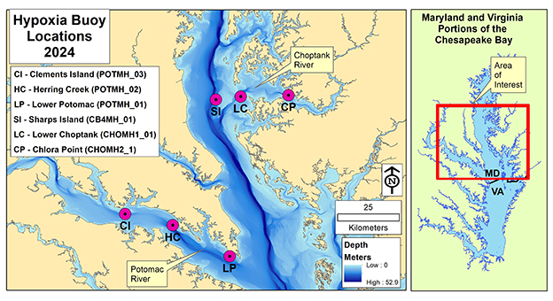
In 2024, six stations were deployed—three each in the Choptank and Potomac rivers.
Each year, the NCBO team assembles a comprehensive report evaluating the health of the hypoxia data. Click through to access the Chesapeake Bay Water-Column Hypoxia Monitoring End-of-Year Data Report 2024 as a pdf file.
2023 Data
In 2023, NCBO deployed one buoy at the mouth of the Choptank River, one at the mouth of the Potomac River, and one in the middle of the Bay near Hoopers Island. Each buoy was deployed for much of 2023. Data from these locations is available for you to download (click on the link and it will automatically download a large Excel file):
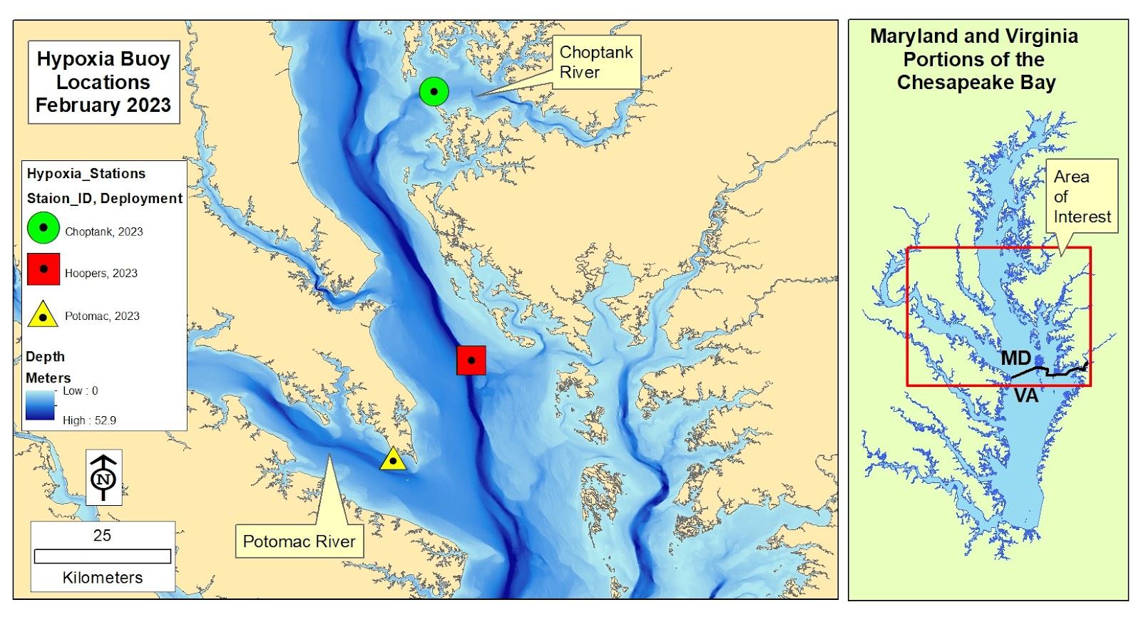
In 2023, three stations were deployed: Choptank, mid-Bay, and Potomac.
You can access the Chesapeake Bay Water-Column Hypoxia Monitoring End-of-Year Data Report 2023 as a pdf file.
This project is supported by the EPA Chesapeake Bay Program Office and is a focus of the Chesapeake Bay Program’s Hypoxia Collaborative.