
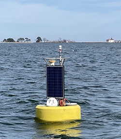
A buoy was first deployed at the mouth of the Potomac River off Point Lookout on June 4, 2007. While this buoy is located far enough south that it has remained in the water over winters, intermittent data gaps do exist due to equipment failures.
"The 16th of June we fell with the river Patowomek (Potomac): feare being gone, and our men recovered, we were all content to take some paines, to know the name of that seven mile broad river: for thirtie myles sayle, we could see no inhabitants" - Captain John Smith, 1608
Travel this route today and you are sure to encounter many inhabitants. Well upstream of the buoy, the Potomac River, which is adjacent to Washington, D.C., is one of the most heavily populated and altered watersheds in the Chesapeake Bay.
Be sure to check the weather forecast before you head out.
For more information on the history of the Potomac and areas surrounding the buoy, please visit:
Data from the buoy is available via data tools.